
An Israeli company is developing NavGuard, a way for drones to navigate without GPS. What does this mean? Could airliners benefit from it?
Satellite navigation is something we all take for granted. Whether we realize it or not, we used it daily without thinking about it. We drive, exercise, geotag photos and/or measure distances with it. Checking which of our phone apps need GPS usage can cause some head-scratching.
So, it’s quite easy to forget that GPS was and still is a military enterprise. It can be turned on and off, several factors can affect its accuracy, and it can be subject to interference. This could annoy us if our smartwatch doesn’t record a sports activity properly. But it’s a much more serious issue for a drone. That’s where NavGuard comes in.
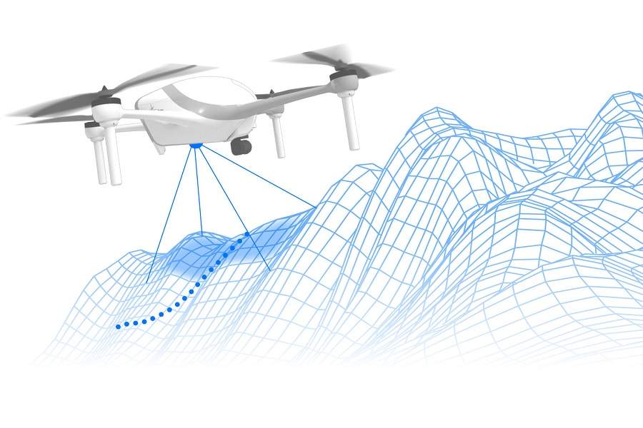
Drones generally figure out where they are and where they’re going using satellite navigation only. “Generally” because there are some very specific, very limited exceptions to this (e.g. crop dusting). Many drones now have small cameras, that allow them to recognize and avoid obstacles. The cameras also allow drones to stabilize in a hover, by maintaining their position against distinguishable features around them.
A Similar Origin And Development
NavGuard didn’t start out as a navigation system for drones. Much like GPS, its first application was military. Asio Technologies developed the system for more or less the same purpose. But it is a self-contained navigation source, with no need for signals from satellites or anything else… except light, since it’s a visual system.
This is an important development because drones aren’t just multiplying, they’re also finding more and more commercial applications. Laws around the world are changing, to make it happen. Using drones for photos or short videos is one thing (and can be commercial, too). But deploying dozens of them at a time to deliver packages over increasing distances, is another matter. Commercial aircraft need multiple/redundant navigation sources, and this is what NavGuard is, for drones.

NavGuard uses cameras on the drone, to identify features in its surroundings, comparing them with a terrain database. It can then derive its own location, altitude, attitude and speed. So even if the drone loses GPS signal completely, it can continue to its destination. Asio Technologies believes that demand for such redundant systems will skyrocket, as drone use expands. The company points out that in some parts of the world, people can buy GPS jammers for “tens of dollars”.
More Ideas Like NavGuard – In Aviation?
But what about aircraft? If systems like NavGuard work fine for drones, why not use them on small planes or even airliners? The answer is that we may well see them on planes, in the not too distant future. You may remember the Airbus ATTOL project. This programme intended to create a way to land an aircraft with ILS-like accuracy, but without any airport infrastructure. And the way it works sounds very similar to NavGuard!
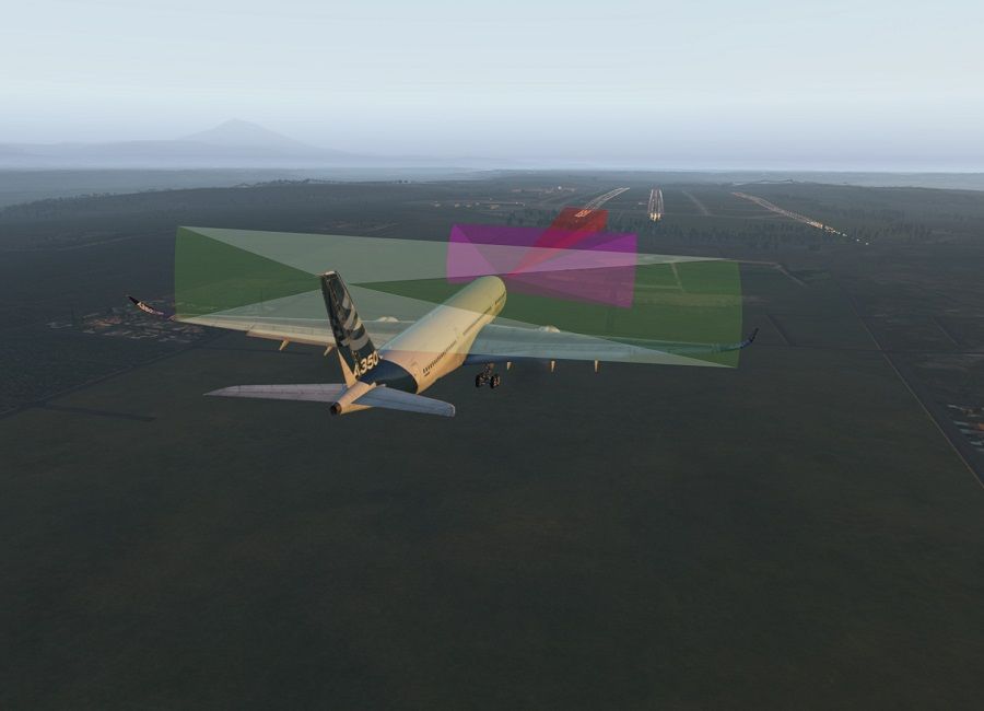
Airbus tested the system on an A350. The system uses software that Airbus calls ‘Wayfinder’, and information from cameras, radar and LiDAR – a radar-like system using lasers. It, too, uses a visual database, along with recognition of runway and taxiway lines and symbology.
Having computers clever enough to recognize visual cues may have been a limitation in previous years. But with phones and other such devices getting cleverer by the week, this is no longer an issue. Technologies like NavGuard and ATTOL could soon rival GPS in utility. Many phones can already measure floor space visually, can’t they?

