
A Boeing 777 crew had to perform a terrain escape manoeuvre, after a weather deviation put them much too close to a mountain, at 9,000 feet!
Pilots have to assess possible risks for each flight – more specifically, for each phase of each flight. But when it comes to the presence of terrain, risk assessments generally involve the departure and the approach. More rarely, risk assessments might involve the en-route phase of the flight as well. But the latter becomes more likely if the flight is very, very short.
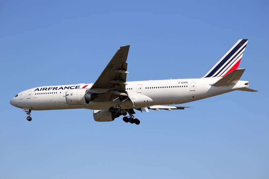
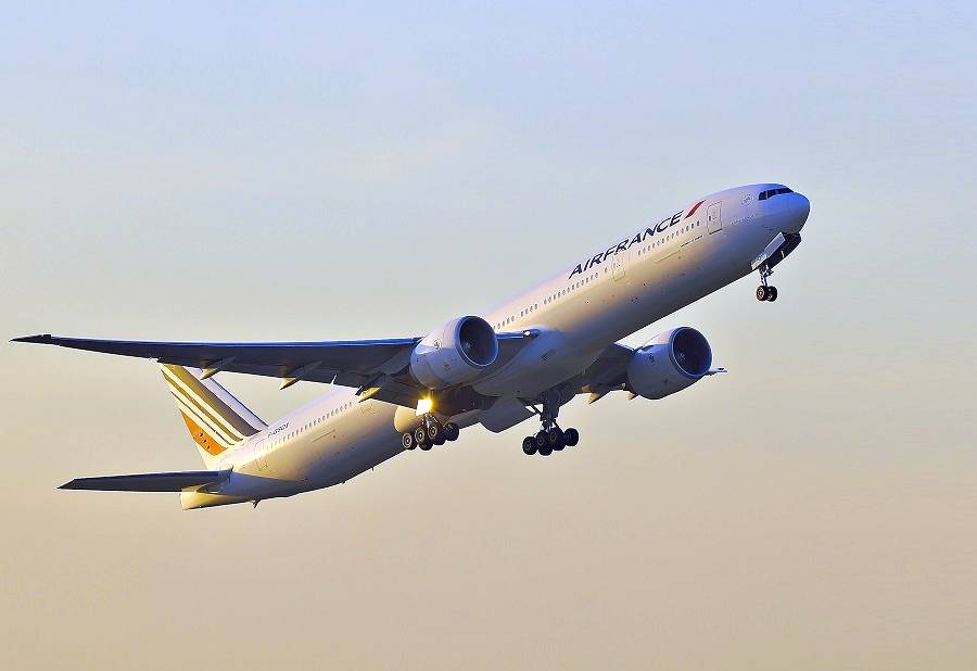
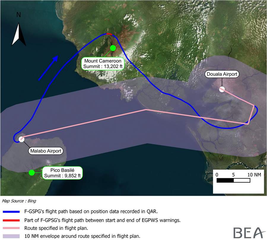
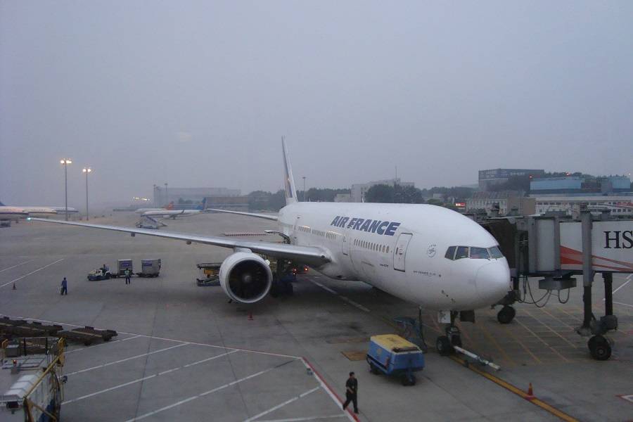
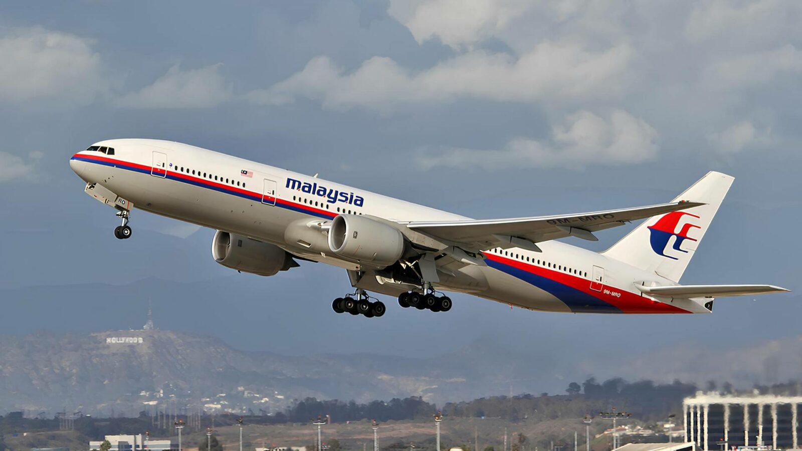
The above has a lot to do with how the crew of this Boeing 777 got much too close to a mountain. This incident happened on the 2nd of May 2015, but investigators released the final report into it today. It involved Air France flight AF-953, from Malabo International Airport (FGSL) in Equatorial Guinea to Douala International (FKKD) in Cameroon. This was a night flight.
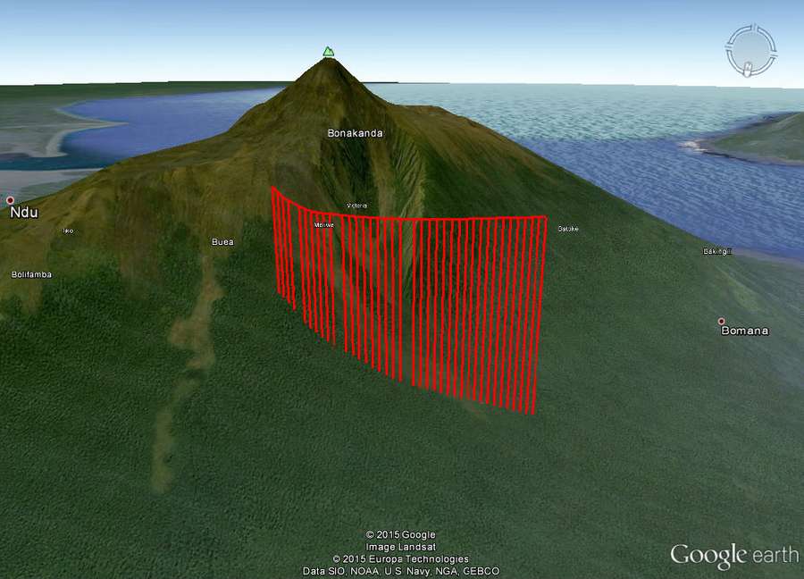
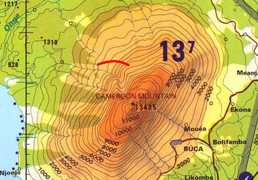
As the crow flies, the distance between these two airports is approximately 115 kilometres (62 nautical miles). Air France typically flies from Paris to Douala, then to Malabo, back to Douala and on to Paris. The mountain that this 777 crew got close to was Mount Cameroon. Its peak is 13,202 feet high, 65 km (35 nm) west-north-west of Douala, i.e. this flight’s destination.
777 Mountain Close Call: A Chart’s Role
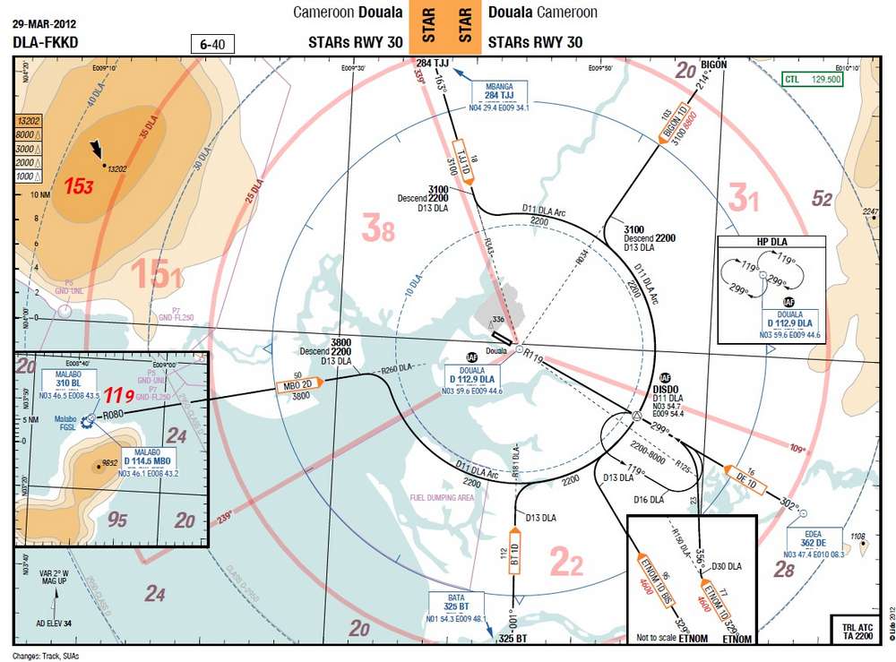
For navigation, pilots would normally use one departure chart for their origin airport, and another for their destination. But these airports are so close that the crew could use a STAR (Standard Terminal Arrival) chart, for runway 30 in Douala. However, their origin airport (Malabo) is only depicted in an inset picture in the chart.
The layout of this chart became a key part of explaining how the crew of this 777 got close to a mountain. After the incident, Air France would change this chart to depict the two airports, and the position of the mountain, fully to scale. Before the incident flight, the crew worried more about the terrain near their origin airport. But more than this, the crew’s main preoccupation was the weather.
The crew weren’t happy with the weather information they had, particularly en route. The weather at their departure airport (Malabo) was good; Douala’s was less so but acceptable, according to the crew. There is a mountain (Pico Basile) close to the departure airport, that the 777 crew would have to avoid. This necessitated a right turn after take-off, which the crew also briefed.
The shortness of the flight meant that the crew briefed the departure and arrival together, on the ground in Malabo. The First Officer would be pilot-flying (PF). Both crew members were quite experienced. The flight also included a relief pilot, also with a lot of experience, albeit relatively new on-type. There was also a cabin crew member, sitting on the flight deck with the three pilots.
Weather Versus Terrain Display Modes
The flight wasn’t busy. In addition to the three pilots, there were eleven cabin crew and just 23 passengers. After departure from Malabo, the crew made a right turn, away from the mountains near that airport. The cruise altitude was just FL090. But instead of continuing their turn east, the 777 crew deviated north, further close to the other mountain. Again, this was taking place at night. The cabin crew member later told investigators that all three pilots concentrated on the weather displays.
This is actually the navigation display (ND) in the Boeing 777, which overlays weather information. Each pilot has their own ND. And when flying close to terrain, Boeing recommends that one pilot sets the ND to show weather (WXR), while the other sets it to ‘Terrain’. This mode doesn’t show any weather information. Instead, it shows elevation information, from the aircraft’s ground database.
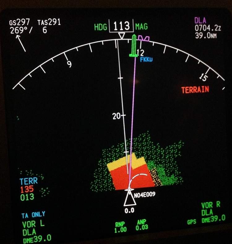
The pilots briefed using one ND to show Weather, the other to show Terrain. However, during the flight, they both set their displays to Weather, as they monitored multiple weather cells near their flight path. As they got close to the mountain to their north, the 777 First Officer noticed what seemed like ground returns. Even in Weather mode, the radar can show returns from the ground. The FO then switched his display to ‘Terrain’, briefly.
777 Getting Close To Mountain
Unfortunately, the 777’s navigation display needs at least 8 seconds to fully ‘populate’ the image with elevation data. The FO switched back to Weather just 6 seconds later. At this point, the aircraft was flying in a northerly direction, west of Mount Cameroon. So the 777 crew were close to the mountain – which was now between them and their destination.
The FO had seen two ground returns on his weather radar, one ahead (north) and one to their right (east). He assumed that the one to their north was Mount Cameroon. He was unsure about the one on the right but thought it might be a false return. Then the Captain suggested he turns to the right, towards their destination. The crew would later recount that the Controller at Douala approach had kept the Captain busy, asking multiple questions. There was no radar coverage in the area.
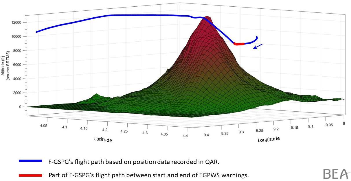
The First Officer was aware that the 777 might be close to a mountain, as he turned to the right. Then 30 seconds after commencing the turn, the crew got their first “TERRAIN AHEAD” EGPWS warning. The aircraft remained in a right turn, with a 25° bank angle. When the first EGPWS warning came, both navigation displays switched to Terrain mode automatically.
Wings Level And Traffic Concerns
Seconds later, the EGPWS warning changed to “TERRAIN AHEAD – PULL UP”. The First Officer quickly disengaged the autopilot, pulling the nose up. He then pushed the throttle levers forward, disengaging the autothrottle seconds later. At this point, the 777 was close enough to the mountain for him and the cabin crew member to make out trees, even at night.
However, the First Officer had not levelled the plane’s wings, before pulling up. The relief pilot caught this and called it out to the crew. The First Officer did this, continuing the climb to a maximum pitch attitude of 15°. In total, the ‘Pull Up’ callout lasted eight seconds. Still close to the mountain, the First Officer of this 777 continued climbing but resumed a right bank. He selected a heading of 150° and an altitude of FL120.
Before reaching this altitude, the Captain told the First Officer to stop climbing. He was wary of the fact that they were climbing without notifying ATC. The Captain had undergone a training session where such an event turned into a mid-air collision. Still close to the mountain, the 777 would eventually reach FL130.
In a calm voice, the Captain asked the First Officer if he was feeling well, to which the First Officer also responded calmly. The First Officer remained pilot-flying, for the rest of the flight. The crew made an uneventful landing in Douala. Consulting with their airline after their close call with the mountain, the crew decided to fly their 777 onwards to Paris.
777 Mountain Close Call – Investigation Findings
However, this onward flight meant that the Cockpit Voice Recorder (CVR) data was lost. Investigators based their work on the flight data recorder and interviews. The investigation focused on the crew’s preparation, their positioning error, their cooperation and task sharing and how they carried out the emergency.
Investigators found that the crew’s preoccupation with the storm cloud masses and ATC conversations led to them not monitoring their flight path. This brought the 777 crew close to the mountain and made their safety altitudes obsolete. The use of both NDs in Weather mode was a contributing factor.
Also, the chart the pilots used (depicting Malabo separately) didn’t highlight the mountain’s significance in the en-route phase. And in other aircraft types, relevant safety altitudes would be displayed on the ND. But this isn’t the case for the 777. Finally, investigators listed the absence of a risk assessment for terrain proximity in the en-route phase of the flight as a contributing factor.
The 777 crew members had their own impressions, regarding their close call with Cameroon mountain. The Captain thought that the three-person crew might have led to a dilution of responsibilities. From his side, the First Officer thought his airline’s Terrain Escape manoeuvre training helped. However, he thought it could be useful to do such training in a turn.
Sources: Aviation Herald, BEA Final Report