
An interesting restriction appearing last Saturday, seemed to relate to something flying to (or from) Area 51. It involved a corridor to the Pacific.
It has had a lot of names. Watertown, Paradise Ranch, Groom Lake, or its official name, which is Homey Airport (KXTA). But to most of the world, it’s simply Area 51. The site (at approximately 37°14’00”N, 115°48’00”W, try it on GoogleMaps) was originally designated for possible atomic testing. This was in the mid-1950s. The whole area around it was out of the public’s reach. And the atomic testing (which was true) kept observers at bay. Some actually stayed in Las Vegas, to watch testing from there!
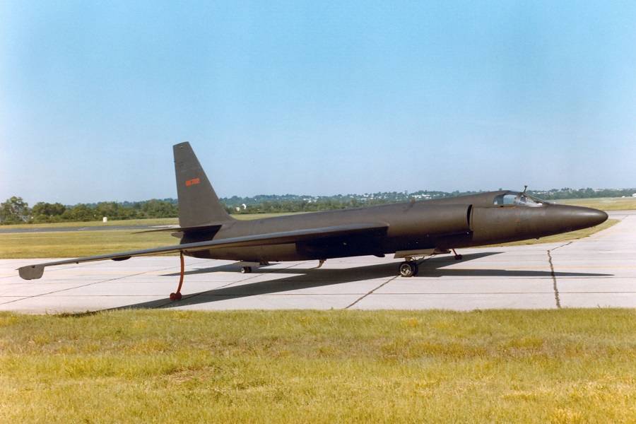
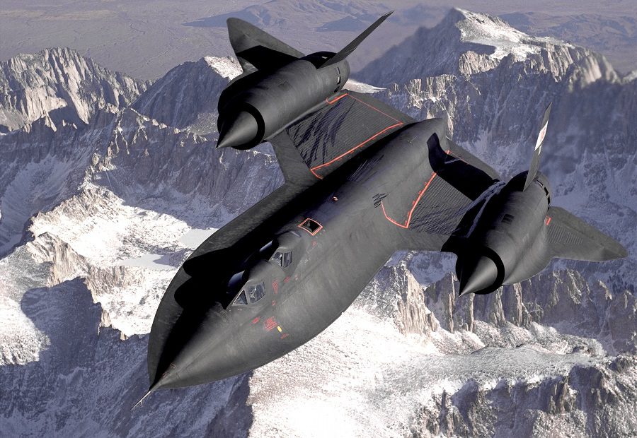
Later on the airport fell out of use. But in the 60s, the emergence of secretive aircraft programs brought what we know as ‘Area 51’ back to life. The first programs to see development there were the Lockheed U-2, and later ‘Project Oxcart’, i.e. the A-12 and SR-71. More recently it played host to other projects like ‘Have Blue’ and the F-117.
Undoubtedly, the site has also hosted projects we haven’t heard of. A lot of people associate it with ‘little green men’ – which probably suits those working there just fine. Personnel flies in and out of Area 51 (and other nearby sites) using ‘Janet’, an airline flying out of Las Vegas. Today, Area 51 is part of a larger area, named the ‘Nevada Test and Training Range (NTTR).
An Oceanic Area 51 Aircraft?
The story first appeared on Saturday, and it seems to involve a “bridge” from the NTTR to the Pacific Ocean. The posting, called an Altitude Reservation Approval Request (ALTRV), appeared on the FAA NOTAM database. It reads as follows:
!CARF 03/165 ZOA AIRSPACE STNR ALT RESERVATION DEFINED AS 10NM
EITHER SIDE OF A LINE FM BEBOP TO PIRAT TO CYPRS TO CANDA TO RUSME
TO LIDAT TO TPH168031. FL450-FL600
2103140145-2103140415
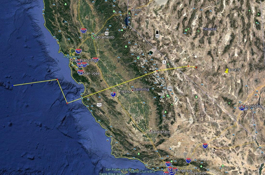
So this is a corridor, 20 miles wide and 15,000 feet high, stretching from the Pacific to the west of the NTTR. The approximate position of the corridor is on the map above (a Google Earth capture). The altitude is from 45,000 feet, all the way up to 60,000, which is the limit of controlled airspace. And this may tell us something about the possible nature of the aircraft, flying to or from Area 51.
Airliners generally don’t fly at 45,000 feet or higher. But some corporate jets can break into that bubble. When the U-2 and SR-71 zoomed around Area-51, they generally didn’t need to worry about traffic. That’s because they flew at 70,000 feet, or even higher. So whatever it is, that needed to use this corridor on Saturday, probably flies a bit lower. Or at least its operators felt that it might need to.
In Daytime, Too!
Then there’s the time. A lot of sensitive activities around Area-51 occur at night. This one was for 17:45-20:15 (local time) on Saturday, the 13th of March. Authorities only gave notice for it the previous day. And nobody actually knows if an aircraft (or drone!) actually flew in that corridor, at that time. Observers report that a lot of activity around this airspace doesn’t involve open radio communications. Military controllers can simply open and close airspace, as required.
https://twitter.com/TheDEWLine/status/1323017727045472256?s=20
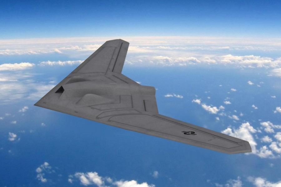
So what could it be that needed this corridor into/out of Area 51? Who knows. It’s something that can fly above FL450, but might not quite be able to manage FL600. The Air Force is working on unmanned reconnaissance platforms, to replace the U-2 and other (?) jets. These include the RQ-170 and RQ-180 drones. And they could well include many other things, too.
We will likely never know what did or didn’t fly the corridor on Saturday. The only comings and goings of Area 51 that we really know about, are the Janet flights. And those 737-600s don’t really fly at the altitudes involved here…